The name Pingrup, like many rural town names in the Great Southern area, is of Aboriginal origin. It was derived from a nearby lake, although the meaning of the word remains unknown. The name first appeared on local charts in 1873.
In 1923, the railway line was extended eastward from Nyabing to Pingrup, prompting the district surveyor to designate land at the railway terminus for a townsite. When determining the name for the railway, the railways department initially considered Pingrup too similar to Tingerup and suggested “Geina,” a name used in the area around 1900. Local settlers, however, found this name unsuitable and proposed “Lake Pingrup” instead. Ultimately, the Lands Department concluded that Pingrup was an acceptable name and not overly similar to Tingerup.
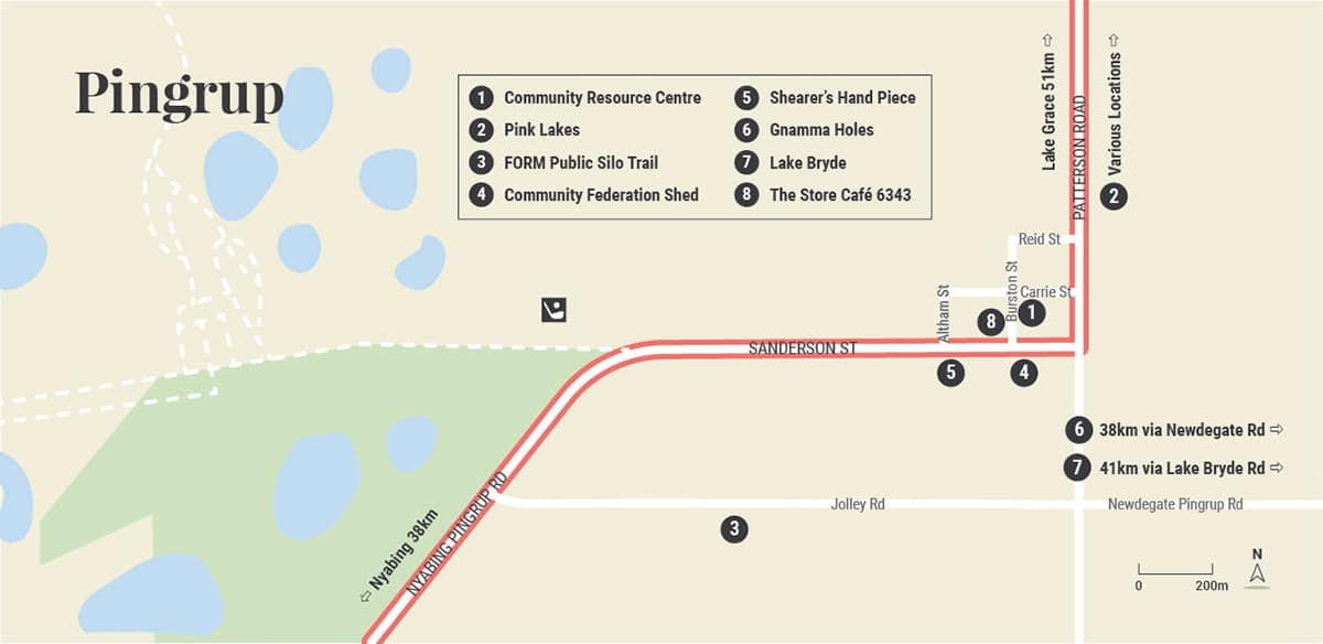
Pingrup Attractions

Lake Bryde Nature Reserve
Lake Bryde is a special seasonal freshwater wetland – listed in Australia’s Directory of Important Wetlands.
It is just one part of the broader Lake Bryde catchment which also includes the nearby Lakeland Nature Reserve and East Lake Bryde. The lakes are located at the head of a chain of lakes that extend south to Lake Magenta Nature Reserve.
Lake Bryde has up to 23 waterbird species, including the rare freckled duck. Up to 7 species of waterbirds have been recording as breeding at Lake Bryde.

The Grain Silos
As part of the PUBLIC Silo Trail the Pingrup silos were the sixth and final mural to be painted as part of the trail in 2018. The designs by Miami based artist Evoca1 reflect the culture of the area with a farmer with lamb, a jockey and a kelpie on a tractor.

Corner Space & Museum at the CRC
This modern building houses the local museum with a fascinating pictorial history of Pingrup, as well as a newly completed retail space selling beautiful homewares and gifts.

Pink Lakes
These colourful lakes are a part of the Chinocup Lake System, which runs in a north-south direction between Lake Grace and Pingrup. Visitors may not be aware that the reason they are pink is due to a microscopic salt-loving bacteria called Halo bacteris that produces red pigment. The lakes are part of an old river system.

Pingrup Races
These country races are a must see! They started as the good old-fashioned Picnic Races in 1919, but by 1950 the day was called The Sports and Foot Races. As the feet were getting sore, attention was then turned to horse racing. If you enjoy a flutter, or a bit of Two-Up, then March is the time to head to the famous Pingrup Races.

Shearer's Hand Piece
This giant-sized replica stands out in all its glory on top of what locals call the ‘Shearer’s Shed,’ encouraging visitors to investigate what it represents. At the height of the 1990s shearers from around the State and the nation would come to Pingrup to pit their shearing skills against each other in regular competitions.

Gnamma Holes
Early Aboriginals are believed to have used this area for watering and resting on their wanderings. The Hollands Rock Tank was built in 1928 using Hollands Rock as a catchment which was to provide water for settlers at Lake Bryde. The Gnamma holes stored water and others were used as fire holes. The area was first explored by John Septimus Roe in September 1848 and John Holland used the water on his trek to the goldfields. The holes are located 35km north-east of town.
Food
Visitor Information
Shire of Kent
Richmond Street, Nyabing
P: (08) 9829 1051
W: www.kent.wa.gov.au
Pingrup CRC
P: (08) 9820 1101


