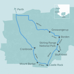
| Recommended Time | 2 nights, 3 days |
|---|---|
| Length | 893 kms |
| Roads | Some unsealed roads in National Parks but all other roads sealed and suitable for caravans |
To climb the third highest peak in WA you need to head to the Stirling Range National Park. Head to the town of Gnowangerup, 348kms south of Perth, using Albany & Great Southern Highways.
Call into the Gnowangerup CRC for visitor information, 47 Yougenup Road.
Using the Gnowangerup-Jerrumungup Road head to Borden and stop off at Louis Lookout, cnr Chester Pass Road, for fabulous views looking south the Ranges.
For a truly unique accommodation experience while in the area make sure you check out The Lily. Choose from 5 accommodation options including spending the night in an original 1944 Dakota DC3 aircraft.
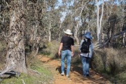
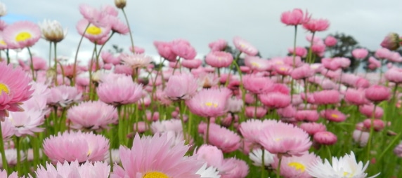
Once you get to the mountains you have plenty of options for walks. Stirling Range Retreat has guided wildflower and bird walks where you get great local information and knowledge. Check ahead for times. They also offer accommodation.
Mt Trio Bush Camp & Caravan Park is a great base for some of the other great walks in the ranges, including:
Bluff Knoll – Medium – 5km 3-4 hours

Mt Trio – Medium – 3km 1.5-2.5 hours
Mt Hassel – Medium – 2km 2-2.5 hours
Talyuberlup – Medium – 3km 2-3 hours
Toolbrunup – Hard – 4kms 3-4 hours
Mt Magog – Hard – 7km – 6-7 hours
Be sure to head to the Mt Trio camp lounge know as the ‘Bluff Knoll Ski Club HQ’ with its wood heater; a cosy way to spend an evening in the bush!
Bluff Knoll Café is open for lunch so call in and say hi to Chris and Jacqueline.
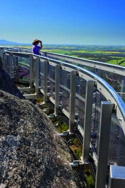
30 kms further south from the Stirling Range National Park is the Porongurup National Park, home to the world class Granite Skywalk suspended on Castle Rock. This is an exciting and challenging walk. Devils Slide, Nancy Peak and Wansbrough are all popular walks in the area, averaging 4-5 kms. https://parks.dpaw.wa.gov.au/site/tree-rock
You can stay in the Porongurup at a number of places or keep heading west to Mt Barker or south to Albany.
Mt Barker Lookout , a short 3 kilometre drive from the Mount Barker Visitor Centre, is a great way for tourists and visitors to geographically orientate themselves. Mount Barker rises to about 147 meters above sea level and the lookout platform offers great views
The Sukey Hill Lookout, 5kms east of Cranbrook, provides a unique view through the ranges to Bluff Knoll. Visitors can to do the round-trip of approximately 120kms along Salt River Road, Red Gum Springs Road, Stirling Range Drive, Formby Road and back onto Salt River Road to Cranbrook with breathtaking views the whole way. This is an alternate route to entering the Stirling Ranges from Gnowangerup.
